DINAMO

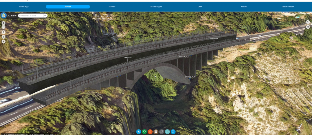
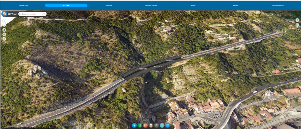
The increasing need to constantly monitor critical infrastructures goes hand in hand with the need to use efficient and effective technologies for preventing catastrophe due to natural hazard or structural failure. Infrastructures, like bridges and viaducts, are rightly monitored during their construction, to measure the reaction of the infrastructure to various stress factors. In the field of static monitoring, satellite data analysis is now the new frontier of “static” environmental monitoring and design support.

DINAMO is an integrated dynamic and static monitoring solution supported by Earth Observation data (SAR and optical imagery), GNSS systems with a network of wireless sensors, hybrid telecommunications systems (satcom) and geographical information systems (GIS).

It’s a multi-sensor, multi-temporal working tool for detecting and giving early warning of possible structural failures, designed with a view to providing a solution to the increasing need for reliable, durable tools for continually monitoring bridges and viaducts.

The aim is to provide a solution able to analyse information from satellite imagery to monitor “buffer zones” where it’s necessary to guarantee and certify any environmental changes, like for example planning permission violations, illegal dumping or any other changes that could impact the integrity of the infrastructure itself.

Our DINAMO solution is based on a Decisional Dashboard (DMD) designed with a user-friendly approach that allows users to access historical data on the infrastructure and its management, and a great deal of geospatial data analysis supported by a professional GIS platform, without the need for specific technical knowledge.

The DMD offers a certain number of tools for accessing the infrastructure input data, interrogating the sensors and SAR analysis, starting the monitoring analysis and viewing the output data for generating periodic analysis reports.

The Dashboard discriminates the SAR analysis of the bridge/viaduct from the surrounding environment. The SAR data on the structure is used to confirm and validate the sensor data, while the surrounding environment data is used to monitor subsidence phenomena and update the computer model interface to prevent mistaken interpretation of the results.

Monitoring

Dynamic and static monitoring of the asset (bridge or viaduct) using Satellite Optical, Satellite Radar, and Gnss technology.

Simplicity

Users must have rapid, secure, multiple and simultaneous access to the platform, and must be capable of accessing the data continually without interruption.

Security

Tampering with data and certifications is prevented by an approved device.

Comparability

Users must be able to compare the monitoring data with an updated theoretical model of the infrastructure.

Service Functionalities

The Dinamo solution is a modular structured service that integrates the following functions:

A PSinSAR module;

GNSS – IoT sensors and controllers;

Ground-based sensors and controllers;

FE computer model of the bridge/viaduct;

3D modelling of the bridge/viaduct derived from instrumental measurements, as alternative to the BIM model of the infrastructure;

Blockchain module for secure communications protocols;

Optional dual communications channel (land-mobile and satellite) to guarantee transmission in emergencies;

Technical Features

Space technology / Resources / space resources used by DINAMO SOLUTION:

GNSS for continual static monitoring to integrate with dynamic monitoring.

SatCom will implement a “service continuity” capacity selected after agreement with Immarsat, Athena Fidus and Iridium)

SAR (Sentinel1) imagery, more specifically PS techniques for integrating shift measurements with the GNSS ones. The Interferometric Synthetic Aperture Radar (InSAR) and Interferometry Persistent Scatterer (PSI) are indeed consolidated methods capable of monitoring surface deformation, however, with respect to GNSS that has precise and continual monitoring features, SAR integrates information based on GNSS with a more spatially aware vision of the geophysical situation of the environment surrounding the bridge/viaduct.

VHR Optical Imagery which will be used as the base map for generating an updated image, a contextual map of the most recent background situation of the territory of the bridge/viaduct and for monitoring changes in the surrounding environment.

Menu